
Onondaga County Neighbors Block Sources
Public records describe parts of a block, not a complete household list. Nearby parcels can be viewed through a map, assessment material can identify the owner carried on that roll, and Syracuse permit data can show a dated property activity. Each source has a different scope. An owner may use a mailing address elsewhere, an applicant may not be an owner, and no single result establishes who is present at an address now. Keep the source date and the person’s role with every note about Onondaga County neighbors.
| Source | What it shows about a block | Access |
|---|---|---|
| Onondaga GIS viewer | Parcel geometry, map layers, owner or address search, and nearby parcel context | Public viewer; layers can depend on zoom |
| Image Mate | Assessment owner, property location, SBL, tax and assessment fields | Portal terms and roll-date limits apply |
| Syracuse BAS portal | City parcel, permit, service-request, and activity information | Public portal; City describes many property and code records from 2011 |
| Public civic context | TNT sector, public meeting, project, or association contact context | No central membership directory exists |
Start with the least sensitive facts: parcel location, boundary, and recorded role. The data can support curiosity about public block context, but it cannot establish an occupant list or justify contact with individuals.
Onondaga County Neighbor GIS Tools
The Onondaga GIS viewer, maintained through County Planning, accepts Owner Name, Address, Find Address, and geometry searches. It also provides parcel search, identify tools, map layers, Measure Distance, Measure Area, and PDF map export. These features help place an address beside adjoining parcel shapes. They do not make the viewer a legal survey or a current-residence file.
| GIS field or tool | Block use and limit |
|---|---|
| Owner Name or Address | Find a record lead, then preserve the returned owner or address label and record date. |
| Geometry search and identify | View parcel relationships around the searched location without treating lines as survey-grade boundaries. |
| Map layers | Compare visible public layers; some appear only at a suitable zoom and can carry different update dates. |
| Measure or PDF export | Document map context, not a legal boundary, FEMA determination, or safety conclusion. |
The county’s GIS disclaimer says parcel boundaries are not survey grade, and FEMA layers are not an official FEMA map substitute. Exact hidden field labels, result pagination, and bulk-export behavior were not located in the official research. Treat those as a Research limitation until checked in the live viewer.
Note: Save the viewer date and visible layers because map labels, source vintages, and layer availability can change.
Syracuse Neighbor Parcel Fields
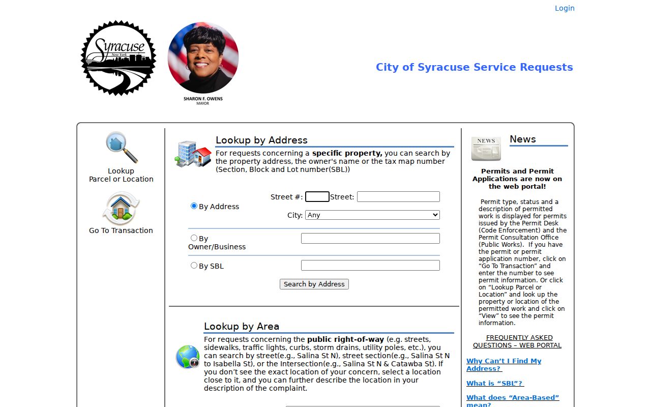
For an address inside Syracuse, the BAS parcel and permit search has direct inputs for Street Number, Street, a City dropdown, Owner/Business, SBL, right-of-way location or intersection, and permit, application, or transaction number. Its Go and View actions lead to parcel, permit, service-request, and activity information. The City’s public-record description says property and code records are generally available from 2011, subject to the portal and record limits.
The successful image below is from the Syracuse BAS search. It shows why address, SBL, and owner searches should remain separate paths rather than being treated as one personal profile.
A permit or application may name an owner, business, applicant, contractor, or inspector. It describes a dated property or administrative activity, not a household roster. Some application information is outside ordinary self-service, and the City says certain details require a subpoena.
Onondaga County Neighbor Roles
Use labels that match the public record. Image Mate and an assessment roll can identify a current owner as of that roll, but the county warns that information may not be current, complete, or final. The town assessor is the more current local source during the assessment cycle. A GIS address label can be a situs address, while an owner record may show a mailing address. Neither label proves occupancy.
Parcel data can also include SBL, class, assessment, exemptions, school district, parcel size, deed book and page, and special districts. Those fields describe land and tax geography. They do not show household composition, faith, daily activity, or a relationship among nearby people. For a permit record, retain the activity date, status, parcel, and named role. For a public civic item, retain the meeting or publication date and identify it as context.
Note: Record owner, applicant, contractor, public participant, historical resident, and occupant as different roles rather than interchangeable names.
Syracuse Neighbor TNT Context
Syracuse organizes neighborhood engagement by TNT area. The research identifies eight TNT sectors and a 16-member board, along with city-sector categories including Downtown, Eastside, Eastwood, Lakefront, Northside, Southside, Valley, Westside, and citywide groups. Public agendas, projects, block-club announcements, volunteer roles, and comments can explain a local issue or civic setting without claiming that any household belongs to a group.
| Community record | Safe block context |
|---|---|
| TNT sector or board material | Public civic geography, project, or meeting context. |
| Neighborhood association contact page | Public institutional contact and stated area, not member names. |
| Permit or planning notice | Dated property activity and named administrative role. |
| Historical directory or newspaper | Dated historical context that does not prove present residence. |
Associations are independent and not sponsored by the City. The research found no central public membership directory. That absence is a Research limitation, not a reason to assemble a roster from scattered mentions.
Map an Onondaga County Neighbor Block
Use a short parcel workflow to see public geographic context near one address. Stop when the question is answered. The goal is to understand the map and its administrative records, not to create a list of individuals.
- Locate the address in the GIS viewer using the address or Find Address route, then note the municipality and whether the visible label is situs or mailing geography.
- Use identify and parcel layers to see adjoining parcel shapes. Record the parcel or SBL and the viewer date, not an assumption about occupants.
- Compare a selected parcel with Image Mate or the local assessment source. Retain owner, situs, mailing, and roll-date fields separately.
- For a Syracuse parcel, test the BAS portal for a dated permit or property activity, preserving its role and status. Use the Onondaga County street directory only when the task genuinely expands to the full street record chain.
County mapping and tax records are useful corroboration, but an unreturned search or an old record does not mean a nearby person or record does not exist.
Note: Keep the original address string beside the municipality, SBL, and source date when comparing records from different systems.
Onondaga County Neighbor Sources
Official records let a reader see the custodian, record date, and legal limit. Commercial neighbor tools may combine older records, but their method, correction route, and update date may be unclear. Neither category turns a parcel owner into a confirmed resident. Prefer the source that directly supports the narrow question, then date and qualify the result.
| Source category | Useful for | Boundary |
|---|---|---|
| Official parcel, assessment, and permit sources | Named record roles, property context, and dates | Owner, applicant, or mailing fields can be stale or nonresidential |
| Official civic and historical sources | Public projects, historical setting, and dated institutions | Not a membership or current-residence list |
| Commercial compiled tools | A lead that needs independent verification | Do not reproduce or rely on a result as proof |
Do not publish sensitive identifiers, full protected addresses, or a combined dossier. Preserve the agency citation and route correction questions to the custodian that created the record.
Onondaga County Neighbor Source Limits
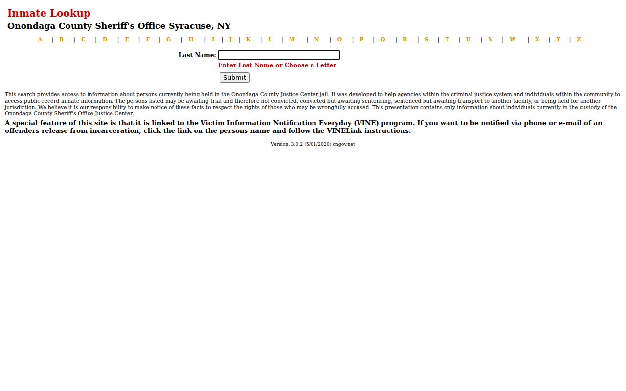
The Onondaga Sheriff inmate lookup is limited to current Justice Center custody. It supports a last-name or alphabetical search and cautions that a person may be awaiting trial and has not necessarily been convicted. It is not a block tool, a residence file, or a way to identify people around an address.
The successful capture from the Sheriff lookup illustrates its agency-specific boundary. Any use should retain custody status and date, avoid personal identifiers, and never treat a missing result as proof of no history.
The New York SORA directory is also limited: online results cover Level 2 and Level 3, while Level 1 information is by telephone under the state’s rules. It has last-name, county, ZIP, custody filters, and CAPTCHA. It is not a general neighborhood search.
The image from the official SORA search is included to show the state’s controlled interface and its limits, not to encourage tracking or republishing sensitive results.
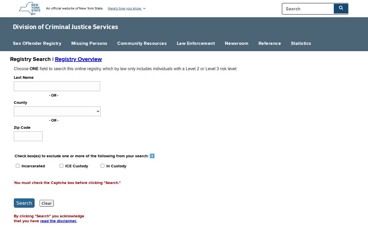
Preserve the registry’s risk level and update date if a lawful official question requires it. A listing is not proof of current presence, a general residency restriction, or a reason to harass or expose someone.
Note: Custody and registry records have separate agency scopes and should never be merged into a single neighborhood conclusion.
Onondaga County Neighbor Privacy Limits
New York’s Address Confidentiality Program provides a substitute mailing address for eligible people and household members who have moved to an undisclosed location. Membership lasts four years and actual addresses are safeguarded, with disclosure only through the program’s law-enforcement process or a court order. Confidential voter registration is separate. Do not try to defeat either protection by cross-linking parcel, court, family, utility, or directory records.
Lawful use. Onondaga County neighbors research is limited to lawful public-record context. Do not watch, harass, intimidate, contact, or expose anyone, and do not collect protected locations or sensitive identifiers.
Renters, household members, utility customers, delivery recipients, minors, and protected addresses are not established by parcel data. A public index or map boundary does not override those limits.
Onondaga County Neighbor Record Gaps
There is no official countywide resident directory, central association membership directory, or comprehensive public neighborhood roster in the reviewed sources. The research also did not locate a comprehensive street-renumbering or annexation index, so old and new address matches require separate verification. Describe a negative result narrowly: name spelling, source, date range, municipality, and access limit. “Not located” does not mean “does not exist.”
For a historical block question, the County Clerk Archives, OCPL Local History & Genealogy, directories, census material, and Sanborn maps may offer dated context. Historical household material needs the same role and date labels, and it should never be converted into a current-neighbor claim.
Note: Recheck map layers, portal fields, and agency access notices because online behavior and data vintages can change.